Big Island Volcanoes
Mauna Kea – Hawaii’s Tallest Volcano
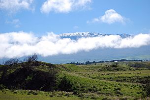
Will Mauna Kea erupt again?
Mauna Kea is presently a dormant volcano, having last erupted about 4,500 years ago. However, Mauna Kea is likely to erupt again. Its quiescent periods between eruptions are long compared to those of the active volcanoes Hualalai (which erupts every few hundred years), Mauna Loa (which erupts every few years to few tens of years) and Kilauea (which erupts every few years). A swarm of earthquakes beneath Mauna Kea might signal that an eruption could occur within a short time, but such swarms do not always result in an eruption. Sensitive astronomical telescopes on top of Mauna Kea would, as a by product of their stargazing, detect minute ground tilts possibly foretelling a future eruption.
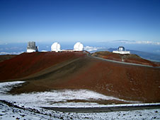
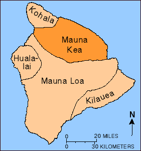
Location: 19.82 N 155.47 W
Elev. Above Sea Level: 4,205 m / 13,796 ft
Area: 2,380 km2 / 920 mi2 (22.8% of Hawai`i)
Volume: >30,000 km3 / >7,200 mi3
Most Recent Eruption(s): At least 7 separate vents erupted between about 6,000 and 4,000 years ago.
Number of Historical Eruptions: none.
Oldest Dated Rocks: 237,000 ± 31,000 years before present
Estimated Age of Mauna Kea: About 1 million years
Volcano Stage: Post-shield Stage (transition from shield stage to post-shield occurred before about 200,000 to 250,000 years ago)
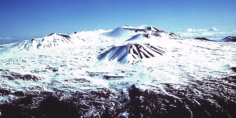
Tall cinder cones atop the summit of Mauna Kea (4,205m) and lava flows that underlie its steep upper flanks have built the volcano a scant 35 m higher than nearby Mauna Loa (4,170 m). Mauna Kea, like Hawai`i’s other older volcanoes, Hualalai and Kohala, has evolved beyond the shield-building stage, as indicated by (1) the very low eruption rates compared to Mauna Loa and Kilauea; (2) the absence of a summit caldera and elongated fissure vents that radiate its summit; (3) steeper and more irregular topography (for example, the upper flanks of Mauna Kea are twice as steep as those of Mauna Loa); and (4) different chemical compositions of the lava.
These changes in part reflect a low rate magma supply that causes the continuously active summit reservoir and rift zones of the shield stage to give way to small isolated batches of magma that rise episodically into the volcano, erupt briefly, and soon solidify. They also reflect greater viscosity and volatile content of the lava, which result in thick flows that steepen the edifice and explosive eruptions that build large cinder cones.
Glaciers on Mauna Kea?
Most people don’t think about snow or glaciers in Hawai`i, but geologists have long recognizd deposits formed by glaciers on Mauna Kea during recent ice ages. The latest work indicates that deposits of three glacial episodes since 150,000 to 200,000 years ago are preserved on the volcano. Glacial moraines on the volcano formed about 70,000 years ago and from approximately 40,000 to 13,000 years ago. If glacial deposits were formed on Mauna Loa, they have long since been buried by younger lava flows.
Even today, snow falls on both Mauna Kea and Mauna Loa. Both volcanoes are so high that snow falls during winter months, perhaps accumulating to a few meters depth. The seasonal snow cover on the steep slopes of Mauna Kea is easier to see from coastal areas than on the gentle, rounded slopes of Mauna Loa, whose summit cannot be seen from sea level.
Reference: Wolfe, E.W., Wise, S. W., and Dalrymple, B., 1997, The geology and petrology of Mauna Kea Volcano, Hawaii — A study of postshield volcansim: U.S. Geological Survey Professional Paper 1557, p. 129, 4 plates.
Mauna Kea: preparing for severe weather
Weather on Mauna Kea can be severe and may include winds over 100 miles per hour, freezing temperatures, and snow storms. “White outs” caused by blowing snow can reducee. In the winter, ice may form suddenly, without warning. The steep paved grades are dangerous with just a thin coat of ice or snow. Visitors trapped on the mountain under these circumstances are in a life-threatening situation–they are in danger of freezing to death. visibility to zero. Deep snow drifts, freezing fog, and ice on the road can prevent passagExtreme weather that prevents the rescue of trapped visitors can last for more than a week. If you are planning to join a tour to the summit of Mauna Kea, please remember that you will be traveling to 13,800 feet and should be prepared for the altitude and cold. At this altitude, weather conditions can change radically in a very short period of time. For this reason, we suggest that you prepare for high mountain weather conditions. For your comfort you should bring the following equipment:
- wool hat
- mittens or gloves
- long underwear (tops and bottoms)
- wool sweater
- long pants
- wind-proof jacket
- sturdy walking shoes and wool socks
- sun screen and lip protection.
Stay Warm! Remember, you can always take extra clothes off, but you cannot put them on if you do not bring them.
Mauna Loa – Earth’s Largest Volcano
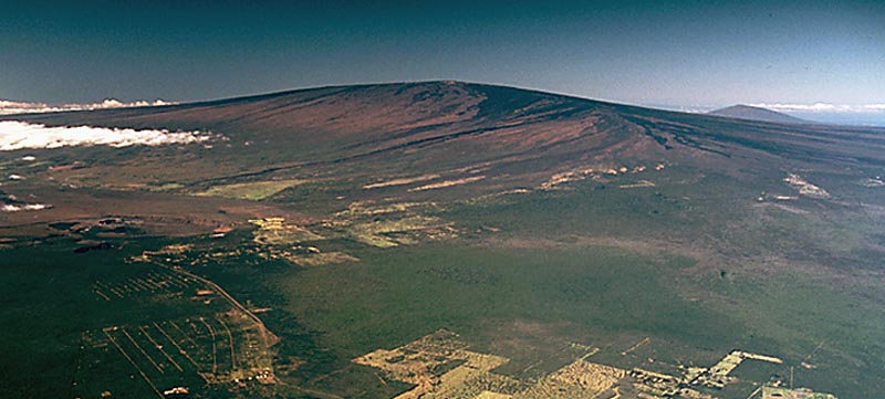
Rising gradually to more than 4 km above sea level, Mauna Loa is the largest volcano on our planet. Its long submarine flanks descend to the sea floor an additional 5 km, and the sea floor in turn is depressed by Mauna Loa’s great mass another 8 km. This makes the volcano’s summit about 17 km (56,000 ft) above its base! The enormous volcano covers half of the Island of Hawai`i and by itself amounts to about 85 percent of all the other Hawaiian Islands combined.
Mauna Loa is among Earth’s most active volcanoes, having erupted 33 times since its first well-documented historical eruption in 1843. Its most recent eruption was in 1984. Mauna Loa is certain to erupt again, and we carefully monitor the volcano for signs of unrest. See current activity for a summary of our monitoring efforts.
Hawaiian Meaning
The Hawaiian name “Mauna Loa” means “Long Mountain.” This name is apt, for the subaerial part of Mauna Loa extends for about 120 km from the southern tip of the island to the summit caldera and then east-northeast to the coastline near Hilo.
Mauna Loa Facts
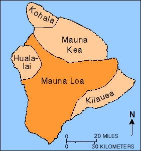
Location: 19.475 N 155.608 W
Elev. Above Sea Level: 4,170 m / 13,680 ft
Area: 5,271 km2 / 2,035 mi2 (50.5% of Hawai`i)
Volume: 80,000 km3 / 19,000 mi3
Most Recent Eruption: March 24-April 15, 1984
Number of Historical Eruptions: 33
Summit Caldera: Name: Moku`aweoweo, “Moku” refers to a coastal land section or islet; “`aweoweo” is a type of red Hawaiian fish. Literal translation is fish section (the red of the fish suggests red lava).
- Dimension: 3 x 5 km, elongated northeast-southwest
- Depth: 183 m deep
- Age: estimated to have collapsed 600-750 years ago
Oldest Dated Rocks: Between 100,000 and 200,000 years ago
Estimated Age of Earliest Subaerial Eruptions:
About 400,000 years ago
Estimated Age of First Eruption of Mauna Loa:
Between 1,000,000 and 700,000 years before present
Hawaiian Volcano Stage: Shield-forming stage
Kilauea – Perhaps the World’s Most Active Volcano
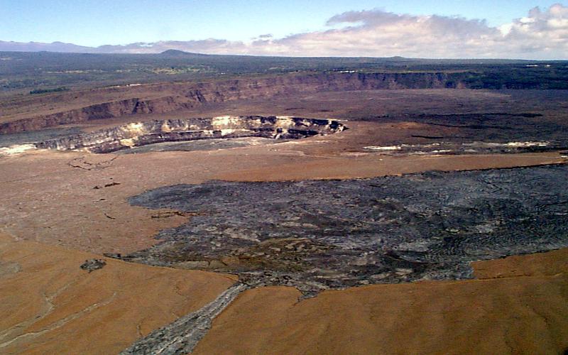
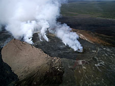
caldera and Halema`uma`u crater (left of center)
Kilauea is the youngest and southeastern most volcano on the Big Island of Hawai`i. Topographically Kilauea appears as only a bulge on the southeastern flank of Mauna Loa, and so for many years Kilauea was thought to be a mere satellite of its giant neighbor, not a separate volcano. However, research over the past few decades shows clearly that Kilauea has its own magma-plumbing system, extending to the surface from more than 60 km deep in the earth.
In fact, the summit of Kilauea lies on a curving line of volcanoes that includes Mauna Kea and Kohala and excludes Mauna Loa. In other words, Kilauea is to Mauna Kea as Lo`ihi is to Mauna Loa. Hawaiians used the word Kilauea only for the summit caldera, but earth scientists and, over time, popular usage have extended the name to include the entire volcano.
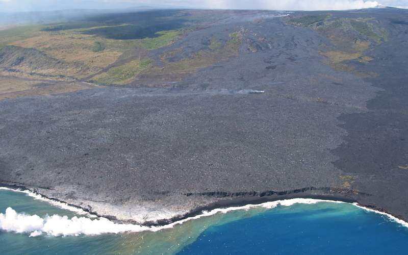
Kilauea is the home of Pele, the Hawaiian volcano goddess. Hawaiian chants and oral traditions tell in veiled form of many eruptions fomented by an angry Pele before the first European, the missionary Rev. William Ellis, saw the summit in 1823. The caldera was the site of nearly continuous activity during the 19th century and the early part of this century. Since 1952 there have been 34 eruptions, and since January 1983 eruptive activity has been continuous along the east rift zone. All told, Kilauea ranks among the world’s most active volcanoes and may even top the list.
Kilauea Facts
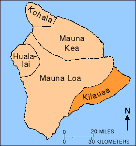
Location: 19.425 N 155.292 W
Elev. Above Sea Level: 1,277 m / 4,190 ft
Area: 1,430 km2 / 552 mi2 (13.7% of Hawai`i)
Volume: 25,000-35,000 km3 / 6,000-8,500 mi3
Hawaiian Meaning: The Hawaiian name “Kilauea” means “spewing” or “much spreading,” apparently in reference to the lava flows that it erupts.
Most Recent Eruption: Continuous since January 3, 1983
Number of Historical Eruptions: 61, not counting the continuous lava-lake activity in Halema`uma`u crater
Summit Caldera: The caldera itself has no Hawaiian name other than Kilauea but houses the famous crater, Halema`uma`u; “hale” is a house, “ma`uma`u” a type of fern. Kamapua`a, a jilted suitor of Pele, is said to have built a house of ferns over Halema`uma`u to keep Pele from escaping her home and causing eruptions. The ploy failed.
- Dimension: 6 x 6 km (outermost faults), 3 x 5 km (main depression)
- Depth: 165 m deep
- Age: probably several incremental collapses 500-210 years ago
Oldest Dated Rocks: 23,000 years old
Estimated Age of Earliest Subaerial Eruptions:
50,000-100,000 years
Estimated Age of First Eruption of Kilauea:
300,000-600,000 years before present
Hawaiian Volcano Stage: Shield-forming stage
Hualalai – Hawaii’s Third Active Volcano
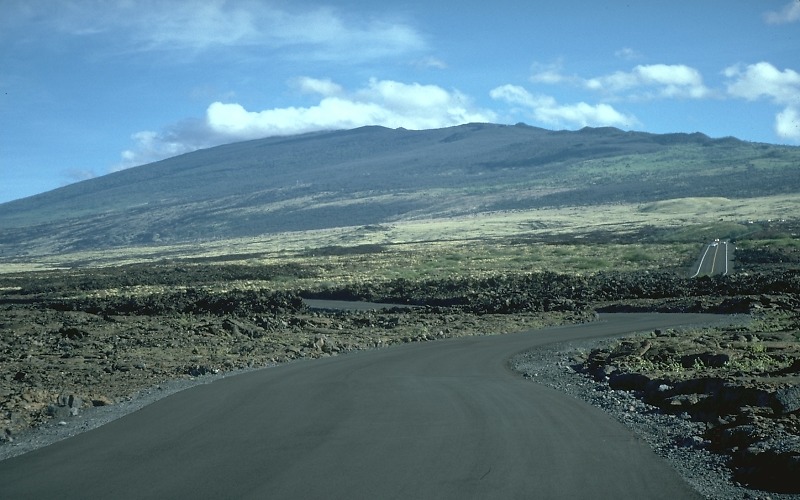
Hualalai is the third youngest and third-most historically active volcano on the Island of Hawai`i. Six different vents erupted lava between the late 1700s and 1801, two of which generated lava flows that poured into the sea on the west coast of the island. The Keahole Airport, located only 11 km north of Kailua-Kona, is built atop the larger flow.
Though Hualalai is not nearly as active as Mauna Loa or Kilauea, our recent geologic mapping of the volcano shows that 80 percent of Hualalai’s surface has been covered by lava flows in the past 5,000 years. In the past few decades, when most of the resorts, homes, and commercial buildings were built on the flanks of Hualalai, earthquake activity beneath the volcano has been low. In 1929, however, an intense swarm of earthquakes lasting more than a month was most likely caused by magma rising to near the surface. For these reasons, Hualalai is considered a potentially dangerous volcano that is likely to erupt again in the next 100 years.
Hualalai Facts
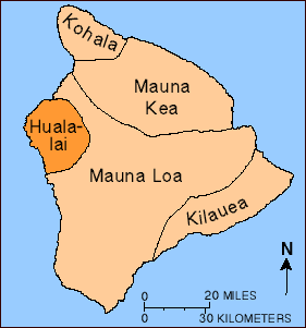
Location: 19.69 N 155.87 W
Elev. Above Sea Level: 2,521 m / 8,271 ft
Area: 751 km2 / 290 mi2 (7.2% of Hawaii)
Volume: 12,400 km3 / 2,975 mi3
Most Recent Eruption(s): 1800 and 1801 A.D.
Number of Historical Eruptions (since 1790 A.D.):One, possibly two (six different vents active)
Oldest Dated Rocks: About 128,000 years before present
Estimated Age of Hualalai: Apparently grew above sea level before 300,000 years ago
Volcano Stage: Post-shield stage
Loihi – Submarine Volcano near Hawaii
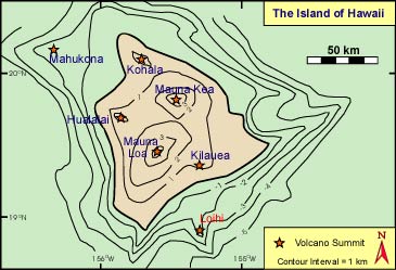
Loihi seamount, sometimes known as the “youngest volcano” in the Hawaiian chain, is an undersea mountain rising more than 3000 meters above the floor of the Pacific Ocean (Loihi is the red-capped nub that is pointed out in the of the image above). Both Loihi and Kilauea volcanoes sit on the flank Mauna Loa volcano, an older, larger, and still active volcano on the Big Island of Hawaii. Loihi sits submerged in the Pacific 19 miles off of the south-eastern coast of the Big Island of Hawaii (this is the grey area labeled “Hawaii” at the top of the image). Although hidden beneath the waves, Loihi is nevertheless taller than Mt. St. Helens was prior to the catastropic volcanism there in 1980. Loihi will not grow to sea level for another 120,000 to 160,000 years, an estimate calculated by using the known growth rates for Kilauea and Mauna Loa, which are in the range 6 to 8 meters per 1,000 years.
Before to the 1970’s, Loihi was not known to be an active volcano. Instead, it was thought to be a fairly common old sea mount volcano of the type that surrounds the Hawaiian islands. These latter volcanoes are similar in age (80-100 million years old) to the sea floor upon which the Big Island of Hawaii sits. This sea floor was itself created some 6000 km away on the undersea volcanic mountain chain known as the East Pacific Rise. It has slowly moved north-westward to the present location of the Hawaiian Hotspot.
